Editor’s Note: This is the third in a three-part series about CIFOR’s work on peatlands in Peru. Read part 1 here and part 2 here.
As Rupesh Bhomia plunges a hollow tube into a swampy spot near the base of several tall palm trees, the mucky water creeps up toward his knees. “I have a sinking feeling!” he said, adding with a laugh: “But here, that’s a good thing.”
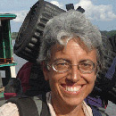
Bhomia, a research fellow at the Center for International Forestry Research (CIFOR), is standing — or sinking — in peat, an accumulation of decomposed leaves, twigs and other plant material that have settled to the bottom of a palm swamp in Peru’s northeastern Amazonian region.

Peru’s tropical forests hold large amounts of carbon — but in such peatlands as this one, twice as much carbon could be stored in the flooded soil as in the trees above, Bhomia said. Because Peru has no comprehensive studies of its wetlands, however, no one knows how extensive the peatlands are or how much carbon they store, according to CIFOR scientist Kristell Hergoualc’h.
As a result, when a swamp is drained for logging, agriculture or development, the amount of carbon dioxide emitted — calculated based on the trees that are cut — could be underestimated, because it does not include the emissions from peat.
This may affect both the greenhouse gas emission reports that Peru must file with international agencies as well as the compensation it could receive for REDD+ (Reducing Emissions from Deforestation and forest Degradation) implementation, Hergoualc’h said. The work she is doing with Bhomia and other researchers as part of the Sustainable Wetlands Adaptation and Mitigation Program (SWAMP) — a collaboration involving CIFOR, the U.S. Forest Service and the Peruvian Amazon Research Institute (Instituto de Investigaciones de la Amazonía Peruana, or IIAP) — aims to fill this information gap.
Measuring carbon underground
Accurate measurements require measuring carbon in the aboveground vegetation, the dead leaf litter and wood on the ground, and the peat layer under the water in the swamp, Bhomia said.
So, in a swamp at the edge of Lake Quistococha, on the outskirts of Iquitos, he and his colleagues have marked six circular plots along a 250-meter measuring tape stretched at ground level through the trees.
Although the distance is not great, walking from plot to plot is slow. The researchers can’t tell by looking at the murky water if the footing is solid or if they’ll sink calf-deep. As they advance along the transect, there’s an occasional loud sucking sound as someone wrests a boot free of the muck.
Bhomia stops in an area he has mapped for peat sampling. He twists a hollow tube into the ground, pulling it out to reveal a meter-long column of dark soil. He cuts samples from different parts of the column, storing them in labeled metal tins.
We need to improve the accuracy of the inventory of tropical peatlands in order to determine the magnitude of the carbon pool and estimate the scale of peat-related greenhouse gas emissions resulting from degradation and land-use change
Back in the laboratory, he will dry the samples and analyze them to measure the amount of carbon in each. Mapping the depth of the peat layer and analyzing samples taken from various places in several dozen peatlands will help scientists more accurately calculate carbon stocks in peatlands throughout the Amazon, he said.
Nearby, CIFOR doctoral student fellow Jeffrey Van Lent is assembling an infrared monitor that will measure the soil’s carbon dioxide emissions. The ecosystem naturally “breathes,” absorbing carbon and releasing carbon dioxide, he said. Measuring that exchange, or flux of greenhouse gas in undisturbed peatlands as well as in degraded swamps will help scientists determine the impact of land-use change — such as drainage of peatlands for agriculture or development — on greenhouse gas emissions.
Monitoring crucial for policy
In the next plot along the transect, university students from Iquitos are counting the trees and noting the species. They use a measuring tape to record the diameter at chest height and a clinometer, a hand-held device to measure the canopy height. With those data, they can calculate the biomass in the swamp and the amount of carbon stored in the vegetation.
The SWAMP researchers are also testing a new method that may enable scientists to develop accurate models for estimating biomass in tropical forests more easily. Using a system called terrestrial LiDAR, which combines laser and radar technology, the scientists can create three-dimensional images of the forest for more precise calculations of carbon stocks.
“We need to improve the accuracy of the inventory of tropical peatlands in order to determine the magnitude of the carbon pool and estimate the scale of peat-related greenhouse gas emissions resulting from degradation and land-use change,” Hergoualc’h said. “That information is essential for supporting greenhouse gas emission reduction policies.”
For more information on the topics discussed in this article, please contact Kristell Hergoualc’h at k.hergoualch@cgiar.org.
CIFOR’s research on forests and nutrition is part of the CGIAR Program on Forests, Trees and Agroforestry. The SWAMP project is supported by funding from the U.S. Agency for International Development (USAID).
We want you to share Forests News content, which is licensed under Creative Commons Attribution-NonCommercial-ShareAlike 4.0 International (CC BY-NC-SA 4.0). This means you are free to redistribute our material for non-commercial purposes. All we ask is that you give Forests News appropriate credit and link to the original Forests News content, indicate if changes were made, and distribute your contributions under the same Creative Commons license. You must notify Forests News if you repost, reprint or reuse our materials by contacting forestsnews@cifor-icraf.org.