We want you to share Forests News content, which is licensed under Creative Commons Attribution-NonCommercial-ShareAlike 4.0 International (CC BY-NC-SA 4.0). This means you are free to redistribute our material for non-commercial purposes. All we ask is that you give Forests News appropriate credit and link to the original Forests News content, indicate if changes were made, and distribute your contributions under the same Creative Commons license. You must notify Forests News if you repost, reprint or reuse our materials by contacting forestsnews@cifor-icraf.org.
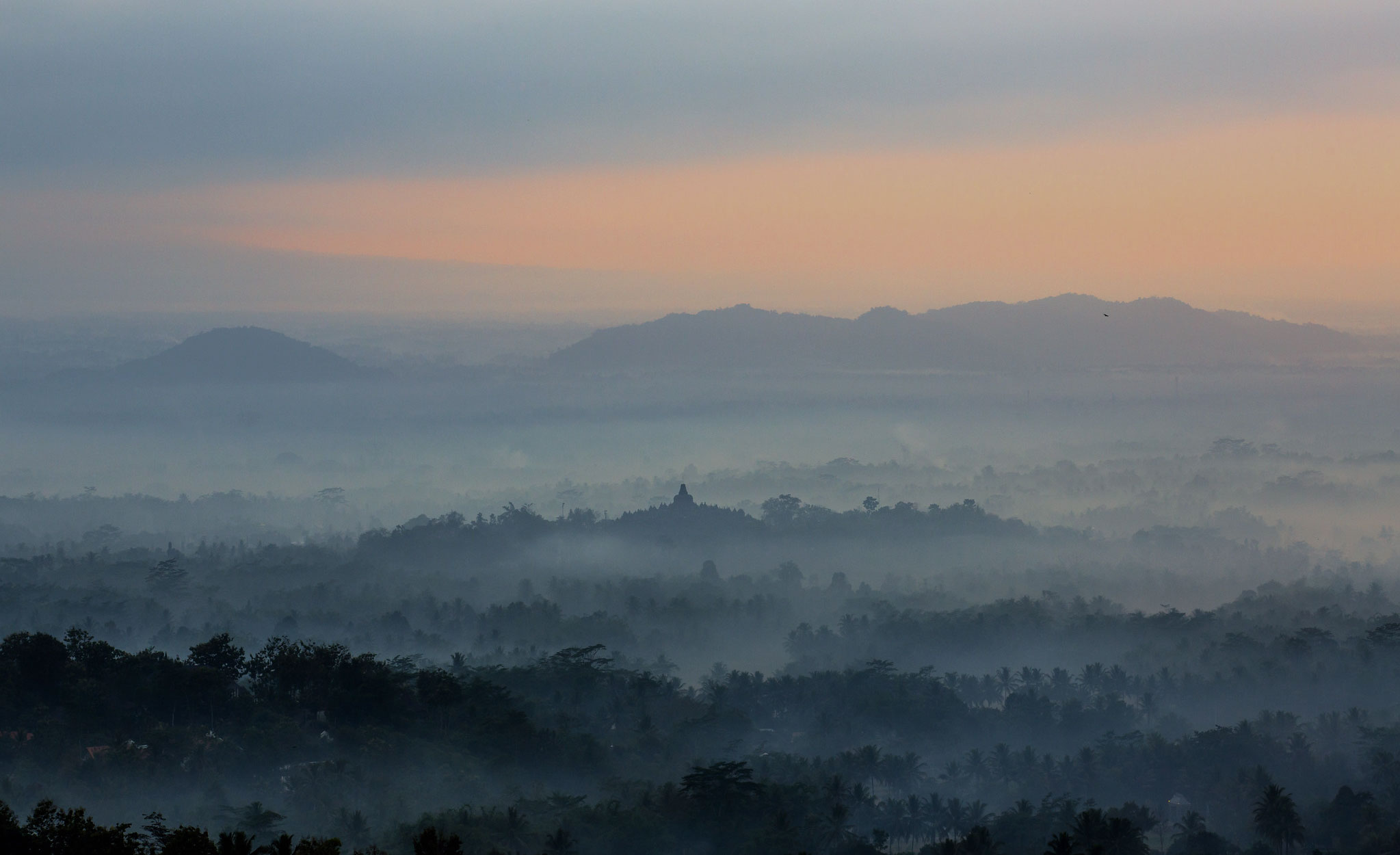
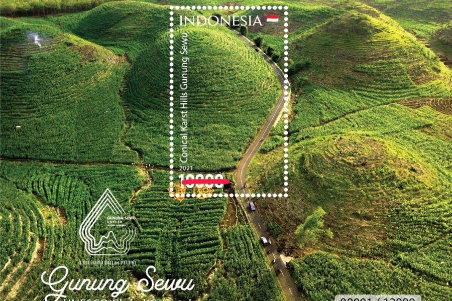
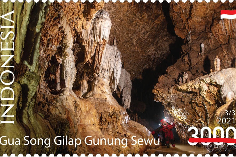
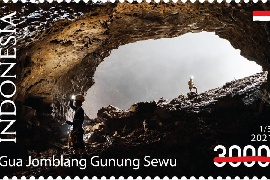
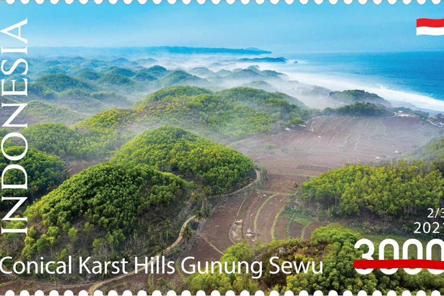
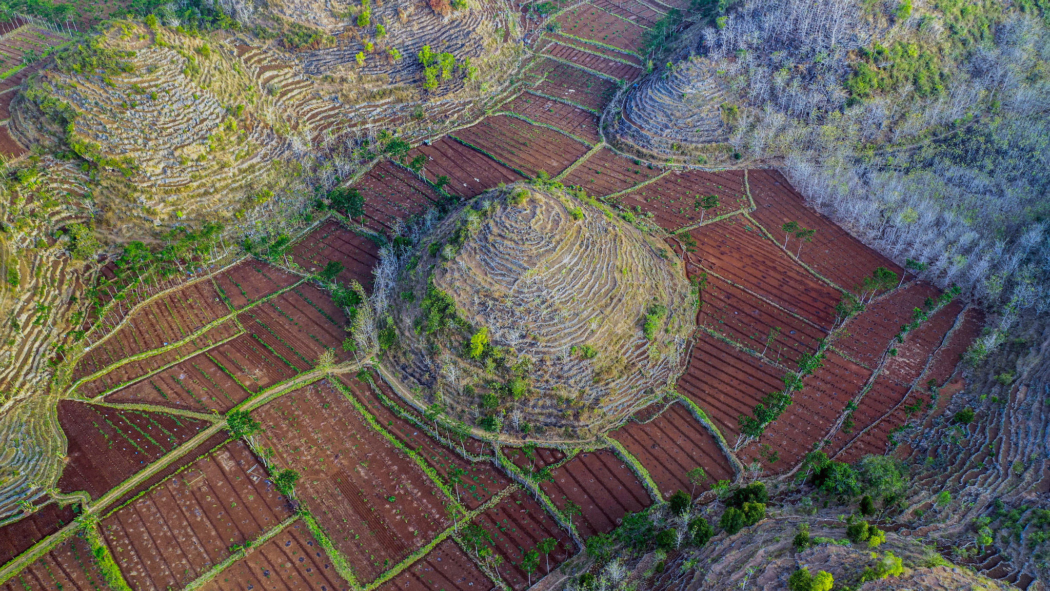
From the air, the mountainous southern coast of Yogyakarta Province in Indonesia presents a unique view of the conical hills of UNESCO Global Geopark, Gunung Sewu, which means “thousands of mountains” in Javanese. The verdant landscape stretches in a 120 km band east to west, from the misty green hills to the coast, sandwiched between the active volcanoes of Merapi and Lawu in the north and the Indian Ocean in the south. A unique karst landscape, it features rocky cliffs, conical hills, caves, underground streams and sinkholes.
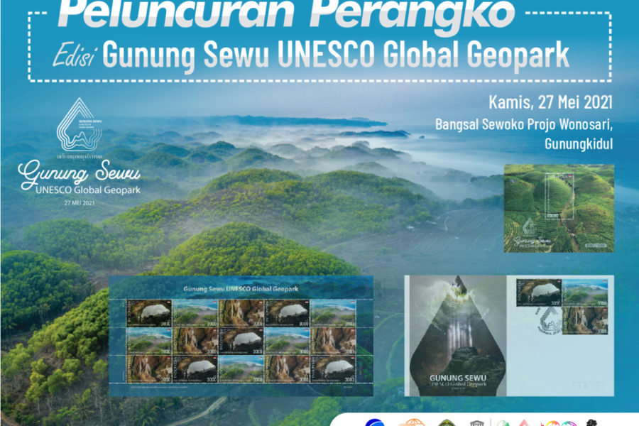
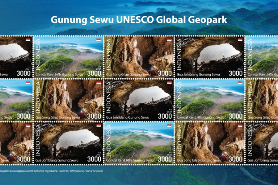
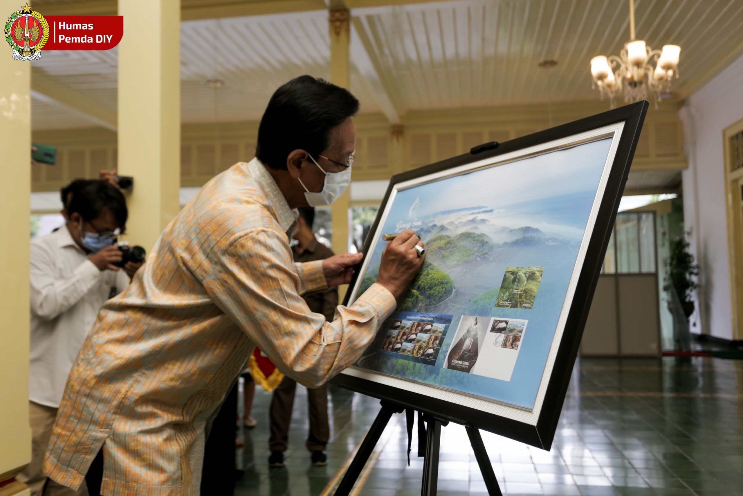
Commissioned by the Center for International Forestry Research (CIFOR), photographers Firman, Muhammad Sidik and Faizal Abdul Aziz from Rekam Jejak Nusantara Foundation captured images mainly in Bribin watershed, which are now documented on a series of postage stamps. Issued by Post Indonesia, the country’s national postal service, they celebrate the 190th anniversary of the Gunungkidul District in Yogyakarta Province, where the geopark is located. At the virtual launch , Sultan Hamengkubuwono X, Governor of Yogyakarta, signed the first day cover, noting that the local community had been empowered by the conservation initiative.
The stamps were issued as part of the Gunung Sewu UNESCO Global Geopark Series to raise its public profile. Situated across three regencies in two provinces in Java’s cultural heartland, “the geopark plays an important part to the ecotourism industry in the area, in which it contributes to both the landscape sustainability and economic self-sufficiency for the people,” said Budi Martono, General Manager of Gunung Sewu Geopark. “Further, the initiatives are contributing to the promotion at the international level on the existence of the Gunung Sewu Geopark in the Global Geoparks Network (GGN) and Asia Pacific Geoparks Network (APGN) forums.”
The Gunung Sewu Geopark and the Gunungkidul Tourism Agency welcomed the initiative. “We hope that this development cooperation will be continued to facilitate the improvement of local community welfare through ecotourism, while ensuring sustainable management,” said Asti Wijayanti, head of Gunungkidul Tourism Agency.
The spectacular karst scenery, which attracts adventure seekers along the Bribin Watershed from upstream to downstream, is central to studies conducted by CIFOR and its partners involved in the Kanoppi Project, which aims to improve smallholder livelihoods through sustainable landscape management. Challenges persist for the karst landscape due to improper natural resources management above and below ground, which causes parts of the fragile karst system to collapse. Erosion, pollution and overuse threaten to contaminate the water and harm the unusual geological formations.
CIFOR scientist Ani Adiwinata, who led the Kanoppi Project Policy Team, identified an abundance of underground water resources, demonstrating that they could be used to help local communities operate more intensive aboveground agriculture and agroforestry practices – as long as they are managed sustainably.
Flooding and landslides caused by unsustainable exploitation of the area threaten the stability of the underground limestone landscape. “In 2017, widespread flooding caused the tourist attractions along the river and the caves to close because the underground river overflowed and endangered the safety of visitors,” Adiwinata said. “Integrated policy frameworks at the district and provincial level can help.”
The Kanoppi Project brought local government agencies – including the regional planning agency – and community representatives together to study the watershed’s problems and develop plans and policies for better management. A multidisciplinary team from Watershed Management Technology Center led by Nunung Nugroho, coordinating scientist, played a role as a strategic partner in this ongoing research. The study found that the Bribin watershed is essential to local livelihoods supporting the creation of ecotourism industries, and securing water availability for residences of the capital city, Wonosari.
The Kanoppi researchers undertook studies of various scenarios of strong institutional arrangements or governance, the policy framework required for landscape-based forest management to improve the livelihoods of communities living near forests. The research develops an integrated participatory baseline in Bribin Watershed, Gunungkidul District, covering land biophysical, water management/hydrology, social, economic and institutional arrangements aspects. Adopting a participatory action research approach in selected villages, the study formulates integrated recommendations for scenarios to foster a sustainable management for the landscape.
The Kanoppi research has led to publication of a series of booklets offering guidance for sustainable management of the karst-based Gunung Sewu Geopark. The first booklet in the series describes the Bribin watershed profile and surrounding village characteristics, covering aspects of its biophysical make up, water management, socio-economic and institutional arrangements.
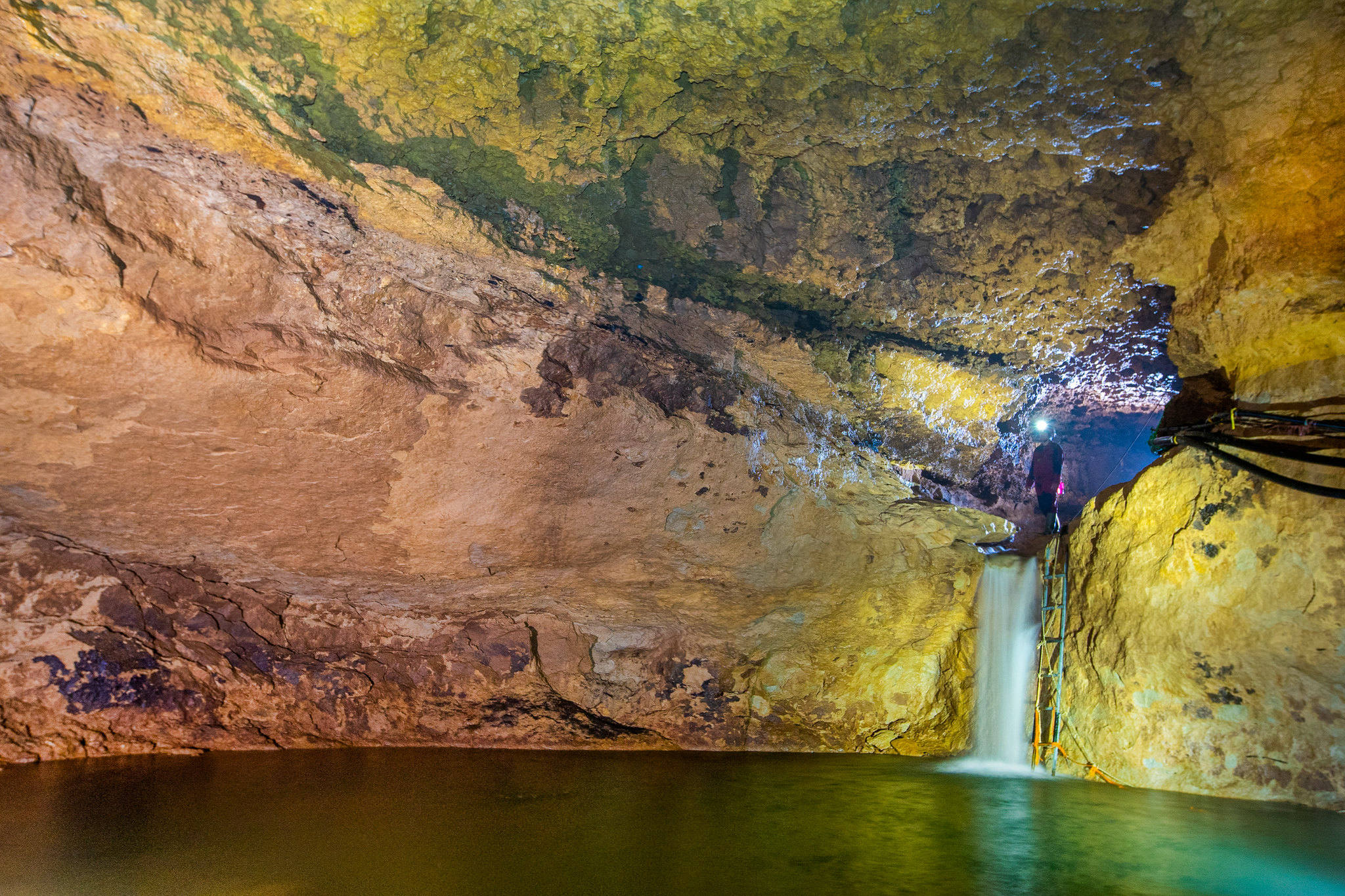
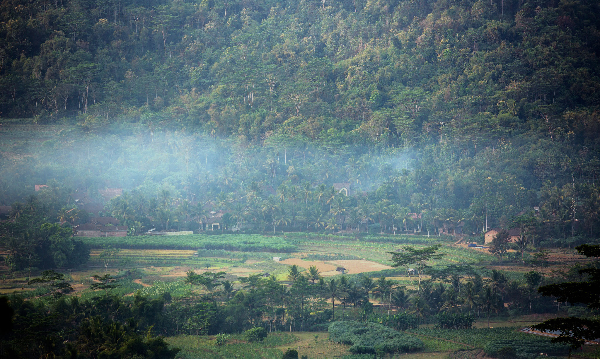
The second booklet describes the sectoral policies and management of the Bribin watershed and the third booklet describes hydrogeology, hydrological systems and the potential and threats of water resources in the Bribin Watershed. The fourth booklet provides a glimpse of the daily life of the people in the Bribin Watershed, and the fifth booklet documents the tourism potential that could be developed around the Bribin watershed.
The sixth booklet describes activities to analyze the accuracy of the Bribin Watershed land use map and the last of the series documents the final stages of activities, including the data verification process and updating of existing reference maps.
“We’re laying the groundwork for a landscape-based management plan in which farming, forestry and ecotourism can sustainably contribute to local livelihoods while conserving the karst ecosystem,” Adiwinata said.
In operationalizing the Kanoppi research recommendations into practice — particularly to encourage the upstream communities to conserve the watershed and its surrounding landscapes — a training initiative was organized in collaboration with the Gunungkidul District Tourism Agency, the Bambubos (Rumpun Bambu Nusantara) and Hay Bambs Indonesia. CIFOR organized a train the trainer session on sustainable community-based bamboo management in early March 2021, which aimed to enhance the sustainable management of karst-based landscapes by encouraging community-based conservation practices. Ideas included planting and managing local bamboo trees while providing additional income, particularly through improved bamboo handicraft-making skills.
In the same month, to raise awareness and seek inputs among the seven villages along the Bribin Watershed involved in the study, a virtual Focus Group Discussion (FGD) was organized in collaboration with the Watershed Technology Management Center. The findings included in the seven booklets were presented and discussed. Inputs discussed in the FGD were included in policy recommendations submitted to the Gunungkidul District Regional Planning Agency to foster integrated karst-based, upstream to downstream watershed management. The most important commitment was the agreement among the villages to collaborate under the Memorandum of Understanding as proposed by the district government.
From research to stamps, unlimited pathways exist for celebrating the Kanoppi conservation campaigns designed to conserve the karst underground landscape and its unique ecosystem – Ani Adiwinata, CIFOR scientist
By Nabiha Shahab, Julie Mollins, and Ani Adiwinata
This research forms part of the Kanoppi research involving the Center for International Forestry Research, the management team of Gunung Sewu UNESCO Global Geopark, Gunungkidul District Government, and World Agroforestry (ICRAF). The research is part of the CGIAR Research Program on Forests, Trees and Agroforestry, which is supported by the CGIAR Fund Donors, including the Australian Center for International Agricultural Research (ACIAR), and the U.S. Agency for International Development (USAID).
We want you to share Forests News content, which is licensed under Creative Commons Attribution-NonCommercial-ShareAlike 4.0 International (CC BY-NC-SA 4.0). This means you are free to redistribute our material for non-commercial purposes. All we ask is that you give Forests News appropriate credit and link to the original Forests News content, indicate if changes were made, and distribute your contributions under the same Creative Commons license. You must notify Forests News if you repost, reprint or reuse our materials by contacting forestsnews@cifor-icraf.org.
