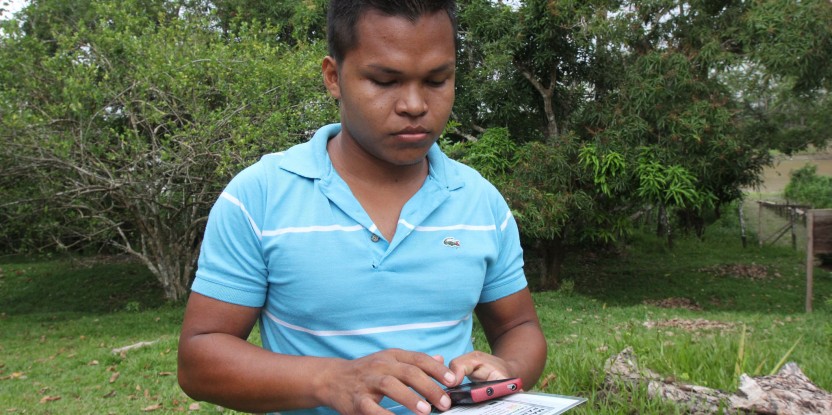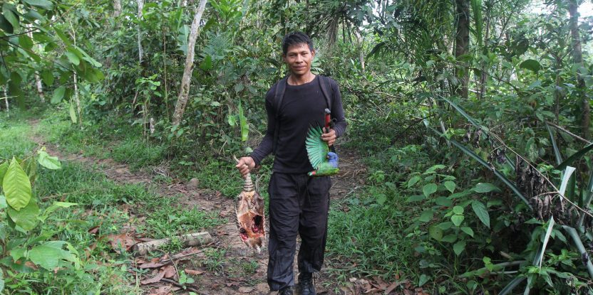
A mobile phone is as much a part of Milton Pinto’s hunting equipment as rubber boots or a shotgun.
And thanks to an app that has turned him and half a dozen other hunters into citizen scientists, researchers are gaining a better understanding of the impact of hunting on wildlife in the Ticoya Reserve or resguardo, an indigenous territory that is home to Ticoya, Cocama and Yagua people.
The hunters are working with researchers from the Center for International Forestry Research (CIFOR) and Colombia’s Fundación Sí who study the hunting, use and commercialization of bushmeat in the area where the borders of Colombia, Brazil and Peru converge along the Amazon River.
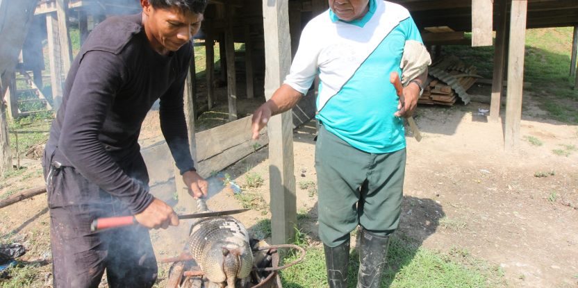
Wild game makes an important contribution to the diet of families in the indigenous reserve. In the reserve’s 23 communities, about 40 men hunt regularly, while others hunt occasionally.
Besides feeding their families, hunters share meat with relatives and friends; some also sell some meat to buy other food items or necessities such as soap and clothing, or to pay school or health-care expenses. But because Colombian law does not allow for small-scale sale of bushmeat, these hunters risk having the meat confiscated if they are caught selling it.
The researchers believe regulations could be changed to allow hunters like Pinto to sell small amounts of meat legally. To do that, however, they need a way to ensure that the hunting is sustainable.
ADAPTIVE MANAGEMENT
Local hunters have a fairly good idea of what they hunt annually, but they don’t know the total amount harvested by all the hunters who share the same territory. This may make it difficult for them to assess the sustainability of their activity as a community, said Nathalie Van Vliet, a research associate with CIFOR.
Regular monitoring—using innovative methods, such as the phone app—can help them determine their total annual harvest and set measures for “adaptive management,” such as quotas for certain species.
“Adaptive management is a method you can use regardless of the situation around you,” said John Fa, coordinator of CIFOR’s Bushmeat Research Initiative.
That form of wildlife management takes into account uncertainties, such as climate change, which could change the impact of hunting on the populations of certain types of animals, he said.
People say we hunters are killing off all the animals, but that’s not true
If the population drops below a certain threshold, hunters can reduce their quotas or take other actions to allow the population to recover.
“It’s a traffic-light system, rather than depending on precise numbers,” Fa said.
The researchers and hunters have tested different methods in the Ticoya Reserve, including a network of camera traps, which showed which species, and how many of each, passed along certain trails in a certain time period.
“But those systems require heavy investment and are not necessarily best for helping people on the ground make decisions,” Fa said.
Instead, hunters can keep track of how much effort it takes to hunt, a method known as “capture per unit effort.” If the populations of prey species drop, hunters must travel farther to find game and expend greater effort to do so.
ANIMAL TRACKING
To devise a monitoring system, the researchers turned to the hunters themselves.
“We were interested in knowing how many animals there are in our territory,” Pinto said. “People say we hunters are killing off all the animals, but that’s not true.”
The hunters began by identifying the places where they hunted along the Amazon, Loretoyacu and Amacayacu rivers, mapping more than 100 kilometers of hunting trails, 40 hunting camps, 20 salt licks and other key places.
It was interesting to see the results, and we became even more committed to the project. We would like to see the monitoring continue and to develop it further
They also identified many of the animals they hunted, including birds, paca, agouti, deer, tapirs, peccaries, and even the occasional anteater.
Some of the preferred hunting spots are close to Puerto Nariño, a town of about 7,000 people near the confluence of the Loretoyacu and the Amazon. Others are as much as a day and a half away by boat, up the Amacayacu River bordering the Amacayacu National Park.
“The camps are strategic points, because they are near the trails that animals use,” Pinto said.
The hunter-monitors began by filling out logbooks, keeping track of details such as where they hunted and the kind of animal they trapped or shot.
But the logbooks—which are hard to fill out in the rain, and even more difficult for someone with little formal education—have been replaced by cell phones and an app.
Each time Pinto harvests an animal, the app guides him through a list of questions—where he hunted; how far he had to walk; what time he left home and what time he returned; what animal he hunted and how much it weighed; what kind of forest he was hunting in; how much he spent on ammunition for the hunt; how much of the meat his family ate, gave as gifts or sold; and details of the sale.
The method uses an app called KoBoCollect, customized by team member Francois Sandrin, which allows users to create surveys, gather data and download it to spreadsheets for analysis.
Pinto, the youngest of the hunters, is as comfortable with the cell phone app as he is with a shotgun or a machete. Even older hunters use the app, he said, although they might turn to younger relatives to help them with data entry.
The monitoring was tested first around Puerto Nariño, and then expanded to areas around communities along the Loretoyacu River, Pinto said. Keeping track during March, May and June 2015 helped them understand how wildlife populations are affected by the rise and fall of river levels with the rainy season.
“I was surprised by the number of animals we caught,” Pinto said. “It was interesting to see the results, and we became even more committed to the project. We would like to see the monitoring continue and to develop it further.”
We want you to share Forests News content, which is licensed under Creative Commons Attribution-NonCommercial-ShareAlike 4.0 International (CC BY-NC-SA 4.0). This means you are free to redistribute our material for non-commercial purposes. All we ask is that you give Forests News appropriate credit and link to the original Forests News content, indicate if changes were made, and distribute your contributions under the same Creative Commons license. You must notify Forests News if you repost, reprint or reuse our materials by contacting forestsnews@cifor-icraf.org.

