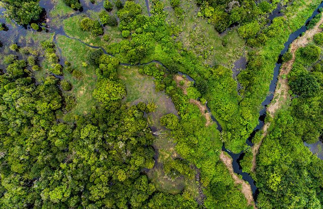
Tropical countries are home to three times as much peat as previously thought, exposing new possibilities and challenges for tackling climate change – according to new research.
Recent findings from the Center for International Forestry Research (CIFOR) and six other research institutions contest the long-held view that Asia is the continent with the most tropical peatland, instead revealing it to be South America.
“We have been able to identify peatlands with more certainty than ever before,” says Martin Herold, Professor of Geo-information Science and Remote Sensing at Wageningen University and co-author of the research.
“The important takeaway is that if there is much more peat than previously thought, we will also have much more peat that we will need to protect.”
REGIONAL AND COUNTRY RESULTS
The scientists’ mapping of 146 countries in the tropics and sub-tropics found 1.7 million km2 of peatlands and 4.7 million km2 of wetlands.
A combination of extended deep deposits in countries like Peru, Ecuador and Argentina; and vast, but shallow, peatlands in the Brazilian Amazon, are largely responsible for South America’s position as the map’s leading contributor to tropical peat stocks (44 percent share of area and volume).
More than a third – 38 percent – of tropical peat area and volume is found in Asia, with Indonesia still the holder of the deepest peat areas.
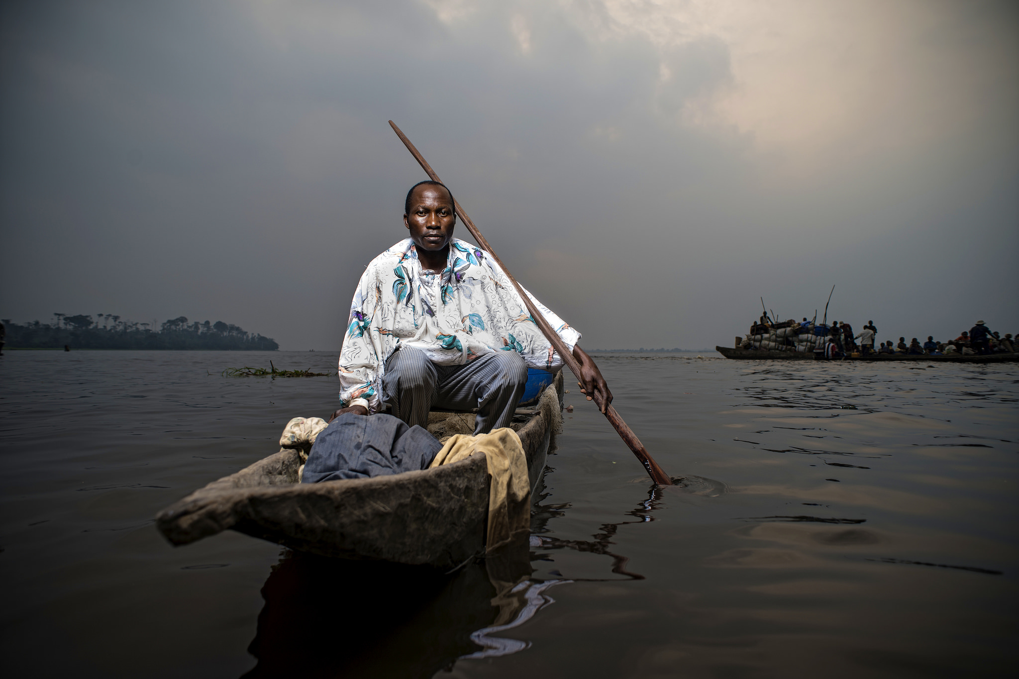
The Congo Basin in Africa now has the most extended peat deposits so far researched in the tropics. Africa as a whole has more peat than earlier believed, but climatic conditions mean it has the least of all continents.
On a country-level, Brazil has the largest amounts of peat in the tropics, with Indonesia coming in second.
“These findings are part of a living document that anyone can access, give their feedback on, and will be updated as new data becomes available,” says Daniel Murdiyarso, Principal Scientist at CIFOR and co-author of the paper. “The map serves as a significant starting point for a range of future work on peatlands and wetlands.”
MODELING AND MAPPING
Scientists developed a unique technique – called an ‘expert system model’ – to produce a map with a high level of detail of the location, extent and depth of peat. It provides comparable, transparent and consistent data across countries and continents.
The model works by combining a variety of data sources and methods, including analyzing the turnover of water and measuring changes in soil moisture recorded in satellite imagery and land forms – like channels, valleys and slopes – that support water inundation.
“Individually, these methods had been in use before, but in this modeling system we combined them and worked on new maps and algorithms,” says Dr. Thomas Gumbricht, the independent researcher behind the modeling and mapping.
“In total, the process took more than four years to develop, refine and finalize.”
Previously, there has been large variability in estimates of peatlands for a variety of reasons – ranging from definitions of peat, difficulties assessing their wetness, a lack of data, and a dearth of corroborative evidence from the ground.
Part of the reason this new model generates larger areas and volumes of tropical peat than previously before seen is thanks to its ability to operate at a finer scale and its multi-source approach.
The study’s authors also posit that peatlands in South America and Africa have previously been under-reported, as access is more difficult on the ground and they have not faced the same level of human destruction as in Southeast Asia, keeping them out of the international limelight.
NEW OPPORTUNITIES
The existence of more tropical peat deposits raises a number of opportunities and challenges for both people and the planet.
As well as acting as important sites of biodiversity, peatlands are crucial for regulating and mitigating climate change. If poorly managed – i.e. dried and set alight to clear space for agricultural use – they can release huge amounts of carbon into the atmosphere. The associated toxic smoke can also have catastrophic health consequences.
The map is designed to help countries limit these threats.
“In accordance with the Paris Agreement, countries party to the UN climate treaty are obliged to submit their Nationally Determined Contributions (NDC), which include their targets for reducing greenhouse gas emissions,” says Murdiyarso.
“Countries housing tropical peatlands may use the map to locate where land-based development could cause problems and compare how policy intervention could improve the business-as-usual approach in the identified location.”
Peatlands highlighted by the map in South America and Africa that are as of yet relatively undisturbed, are already facing the threat of increased droughts, fires and development, such as anticipated logging concessions and road-building.
“We have learned the consequences of poor management and unsustainable development programs in peatlands through our experiences in Southeast Asia,” says Rosa Maria Roman-Cuesta, a scientist with CIFOR and co-author of the research.
“We must use these new maps to raise awareness in governments in Africa and South America that host large peat deposits so that conservation is promoted, restoration is enhanced – and, when development is a must, sustainable land practices are applied.”
People who live and work on the wetlands identified across the world will also require support.
“Our concern is that the map should be used beyond carbon purposes,” says Murdiyarso. “We need to use these findings to help identify hot spots of peatland ecosystem services, from which tangible benefits may be generated, such as sustainable livelihoods for local people.”
FUTURE AIMS
The scientists stress that further work is needed on the ground as part of CIFOR’s ongoing work on peatlands, to test the model’s findings, gather more information on mountainous regions and check if the peatlands identified are being disturbed.
A global map – encompassing boreal and temperate areas – could also be a long-term project.
In the meantime, the research team hopes the map will be used on a local and regional level to stop the destruction of peatlands and help countries build sustainable development programs that will allow communities to mitigate and adapt to climate change.
“We need to take swift action. Even though peat forms very slowly over millennia, it can be destroyed very quickly in just a few years,” warns Herold.
This research was carried out under the Sustainable Wetlands Adaptation and Mitigation Program (SWAMP) – a collaborative effort between the Center for International Forestry Research (CIFOR) and the U.S. Forest Service (USFS).
We want you to share Forests News content, which is licensed under Creative Commons Attribution-NonCommercial-ShareAlike 4.0 International (CC BY-NC-SA 4.0). This means you are free to redistribute our material for non-commercial purposes. All we ask is that you give Forests News appropriate credit and link to the original Forests News content, indicate if changes were made, and distribute your contributions under the same Creative Commons license. You must notify Forests News if you repost, reprint or reuse our materials by contacting forestsnews@cifor-icraf.org.


