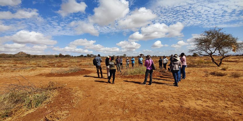
On 8 August 2023, twenty-six restoration practitioners and stakeholders set off from Oloitokitok – a small town on the green slopes of Kenya’s Mount Kilimanjaro – to Mbirikani Group Ranch in Kajiado County. There, the Centre for International Forestry Research and World Agroforestry (CIFOR-ICRAF) and Big Life Foundation were holding a field visit as part of a two-day learning event on monitoring rangeland restoration – specifically on the assessment methods, data, and evidence base that is critical for long-term restoration impact.
Driving through the landscape, the participants observed swaths of bare soil – clear evidence of the ongoing drought in the area. “These soils are highly susceptible to erosion and degradation,” said CIFOR-ICRAF soil scientist Leigh Winowiecki, as she knelt to scoop some in her hands. “We need to protect this critical ecosystem.” The group also saw livestock and wildlife droppings and caught a glimpse of a gerenuk (giraffe gazelle) – and the skull of a wildebeest! According to participant Petronilla Nduthu, a livestock expert at Kenya’s State Department of Livestock (MOA-SDL), more than 2.5 million livestock have died in Kenya in those three years.
Consisting of participants from MOA-SDL, the Maasai Wilderness Conservation Trust (MWCT), Big Life Foundation, JUSTDIGGIT, National Drought Management Authority, International Union for Conservation of Nature (IUCN), and Kenya Water Towers Agency, the workshop participants were all part of the Green Climate Fund (GCF)-funded project Towards Ending Drought Emergencies: Ecosystem Based Adaptation in Kenya’s Arid and Semi-Arid Rangelands (TWENDE). TWENDE’s mission is to positively impact 620,000 people in eleven counties and restore over 500,000 hectares of degraded rangelands.
“The Government of Kenya, through the TWENDE project, has brought in experts from research, extension, and the private sector to develop solutions to build resilience to these recurring droughts,” said Nduthu. The workshop aimed to build capacity on rangeland restoration assessment methods, raise awareness on the importance of monitoring restoration and generating evidence on the impact of interventions, and build capacity on data interpretation and use. During the field visit, various project stakeholders demonstrated their soil and rangeland health restoration interventions and field monitoring tools.
Representatives of Big Life Foundation shared their work at the Loosikitok restoration site, where they have been installing earth bunds for the past three years. A bund is a two-pronged intervention that first restores soil health by slowing or stopping soil erosion, and then supports the growth of pasture. Big Life is also using the earth bunds to reintroduce grass species fit for arid and semi-arid rangelands, by covering them with thorny twigs to protect the grass from animals until it seeds. So far, they’ve dug 110,000 bunds over an area of 3.4 hectares. During Big Life’s presentation, several elders from the local Maasai community joined the group, and empasized that they support the project and are keeping their livestock away from the bunds.
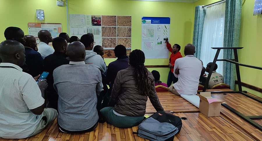
Participants from MWCT presented the Monitoring Rangeland Health tool, which they use to conduct vegetation cover assessments and other observational land health indicators such as erosion, soil surface hardness, and the presence of grass that has been grazed. CIFOR-ICRAF scientists then shared their Land Degradation Surveillance Framework (LDSF) and the Regreening App. LDSF is a systematic, unbiased sampling framework that measures multiple indicators – such as vegetation cover, land degradation, soil hydrology, and soil health indicators – at the same geo-referenced location. Its rangeland health module is designed to assess key indicators of rangeland health, including a complete inventory of grass, forb, and woody species, which is absent in many other assessment approaches. “Apart from using simplistic and cost-effective equipment, LDSF gives the various stakeholders a comprehensive way to measure vegetation and soil health in a harmonized manner, enabling comparisons for different sites,” observed David Okul, a conservation manager at MWCT.
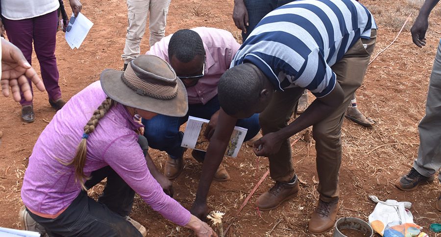
The Regreening App, meanwhile, is a free mobile-based application designed to help partners and users collect information on how farmers are managing and protecting trees on their farms. It facilitates the collection, reporting, and verification of the households reached and hectares restored, meaning restoration practices can be tracked on the ground through assisted citizen science. The app has over 200,000 downloads in West and East Africa.
Since TWENDE launched in 2021, CIFOR-ICRAF has conducted soil sampling and analysis in the Chyulu, Sabarwawa, and Mid-Tana River landscapes. Soil samples were analyzed at the CIFOR-ICRAF Soil and Land Health Laboratory. Data and evidence from the Chyulu landscape were presented to the stakeholders during the workshop for further interaction and discussions. These data comprise of rangeland health indicators such as tree cover, soil erosion, perennial grass species inventories and soil organic carbon. participants also dived into the use as well as opportunities and barriers to improve data use and evidence. For example, the most common perennial grass species at the Chuylu LDSF site were Sporobolus helvolus, Cenchrus mezianus, and Cenchrus ciliaris. While the most common tree species was Balanites aegyptiaca.
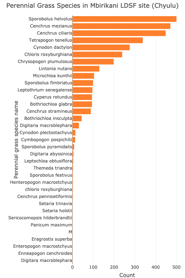
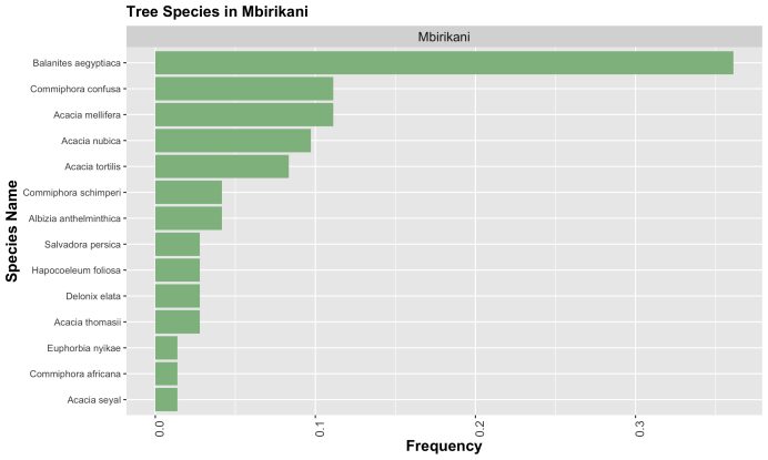
The data and evidence discussions were key in raising awareness of the importance of data in monitoring restoration. It was also a way of building capacity on data interpretation and use. Efficient use of data and evidence is critical for sustainable landscape restoration efforts and impact.
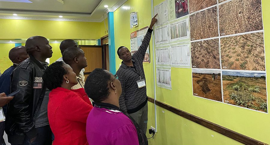
‘This workshop is very helpful because we have been able to visualize how to handle data in a way that is beneficial for everyone,’ remarked Ernest Lenkoina, Big Life Foundation Restoration Manager based at Mbirikani. ‘This will allow harmonized and synergistic use of the data within the TWENDE project. Also, LDSF has proven to be a dynamic monitoring tool in the rangelands.’
We want you to share Forests News content, which is licensed under Creative Commons Attribution-NonCommercial-ShareAlike 4.0 International (CC BY-NC-SA 4.0). This means you are free to redistribute our material for non-commercial purposes. All we ask is that you give Forests News appropriate credit and link to the original Forests News content, indicate if changes were made, and distribute your contributions under the same Creative Commons license. You must notify Forests News if you repost, reprint or reuse our materials by contacting forestsnews@cifor-icraf.org.