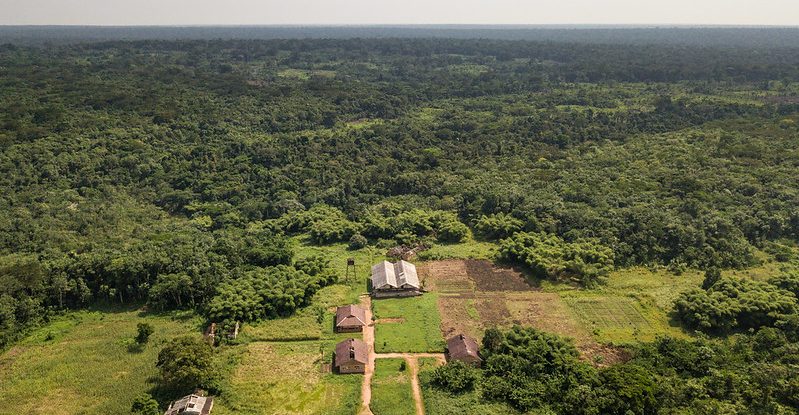
Land use planning (LUP) is critical for peaceful development in Central Africa. But progress in developing and implementing national LUP public policies is sluggish across the region, according to experts in the recent report on the state of Congo Basin forests produced by the Central Africa Forest Observatory (OFAC) – and governance issues, they say, are largely to blame.
LUP policies seek to organize human activities in a predetermined geographical area based on long-term objectives. In doing so, they must contend with a wide range of conflicting interests – particularly between economic development and the preservation of natural resources. A case in point is striking a balance between the Sustainable Development Goals (SDGs) of reducing poverty (SDG 1) and ending hunger (SDG 2), while preserving life on earth and ecosystems (SDG 15). Demographic and climatic changes are likely to complicate the mix further, through direct effects such as population displacement and fires, and indirect effects through the degradation of food resources, natural forests, and biodiversity.
In the countries of Central Africa, much current LUP reflects decisions that date back to the colonial period. In Cameroon, for instance, the country’s unique colonial history led to strong political and administrative impacts on its present-day land tenure system. Before independence, vast tracts of land were allocated to large-scale, mainly forestry and agro-industry based, concessions. “This trend continued after independence, when the government created new concessions, particularly for mining and the agro-industry,” said Donald Djossi of OFAC Yaounde, one of the contributors to the report. However, the goal of nature conservation was also in the national policy milieu relatively early on, beginning with the establishment of parks and nature reserves during the colonial period, which was then continued post-independence under the impetus of international non-governmental organisations. In 2016, the Cameroonian government established a National Programme for Sustainable Territorial Development (SNADDT), which has helped the country to undertake a process of spatial organization and rational development of its national territory at different levels and scales based on its ‘Vision 2035’ plan. Within the SNADDT, the smallest-scale LUP tool is the Municipal Development Plan, which holds the potential to grant wider legal recognition of customary land tenure and prevent local land conflicts.
In DR Congo, the largest country in the Congo Basin at 2.3 million square kilometres, the development of LUP policies has experienced several ups and downs. Until 2015, the country had no policy or law organizing its LUP. Early attempts put in place pre-independence, in 1949, were geared at increasing the profits of mainland Belgium. However, DRC has made some progress with the production of draft legislation, and a draft LUP policy is currently under discussion in parliament. Despite these efforts, however, the harmonization of LUP across DRC remains a challenge due the vastness of the country. “The many usage conflicts in the use of space and resources are due to several shortcomings: the absence of a law on LUP and of sectoral legislation (such as land and mining codes) that is developed in a cross-cutting way, and a lack of planning tools at all administrative levels (national, provincial, and local),” said Prince Lungungu, a DRC-based lawyer and researcher in environmental and local community law and another contributor to the report. “In addition, poor sharing of responsibilities and a lack of coordination among ministries has run counter to consistent LUP management.”
In Burundi, landlocked geography, population density – it’s Africa’s third most densely populated country, with over 300 inhabitants per square kilometre –, and the degradation of natural resources present interrelated challenges. Natural resource management of natural resources was included very early in Burundi’s LUP, as the colonial Belgian administration created forest plantations as early as 1930 to meet the firewood needs of local populations and the first industrial activities. When the country gained independence, LUP was integrated into various ministries, but overall coordination remains lacking, say the authors.
Rwanda is also densely populated, with more than 12 million inhabitants and an average density of nearly 459 inhabitants per square kilometre. This has prompted the expansion of agricultural land at the expense of forest cover. Seventy percent of the country’s surface has so far been allocated to agriculture or forestry activities, while about 9% is currently classified as a protected area.
While institutional arrangements to facilitate LUP vary from one country to another, the researchers say there is a strong desire in many communities to round out the predominantly top-down, state-led decision-making processes that have characterized LUP so far with bottom-up processes originating from local and traditional communities. If the means are available to coordinate these two decision-making trends, say the authors, this will limit conflicts while promoting environmentally friendly development.
This article is also available in [French]
We want you to share Forests News content, which is licensed under Creative Commons Attribution-NonCommercial-ShareAlike 4.0 International (CC BY-NC-SA 4.0). This means you are free to redistribute our material for non-commercial purposes. All we ask is that you give Forests News appropriate credit and link to the original Forests News content, indicate if changes were made, and distribute your contributions under the same Creative Commons license. You must notify Forests News if you repost, reprint or reuse our materials by contacting forestsnews@cifor-icraf.org.
